

क्या है PDO, जिसने अल-नीनो को दबाकर गुजरात में तगड़ी बारिश कराई – what is Pacific Decadal Oscillation PDO causes Gujarat Heavy Rainfall
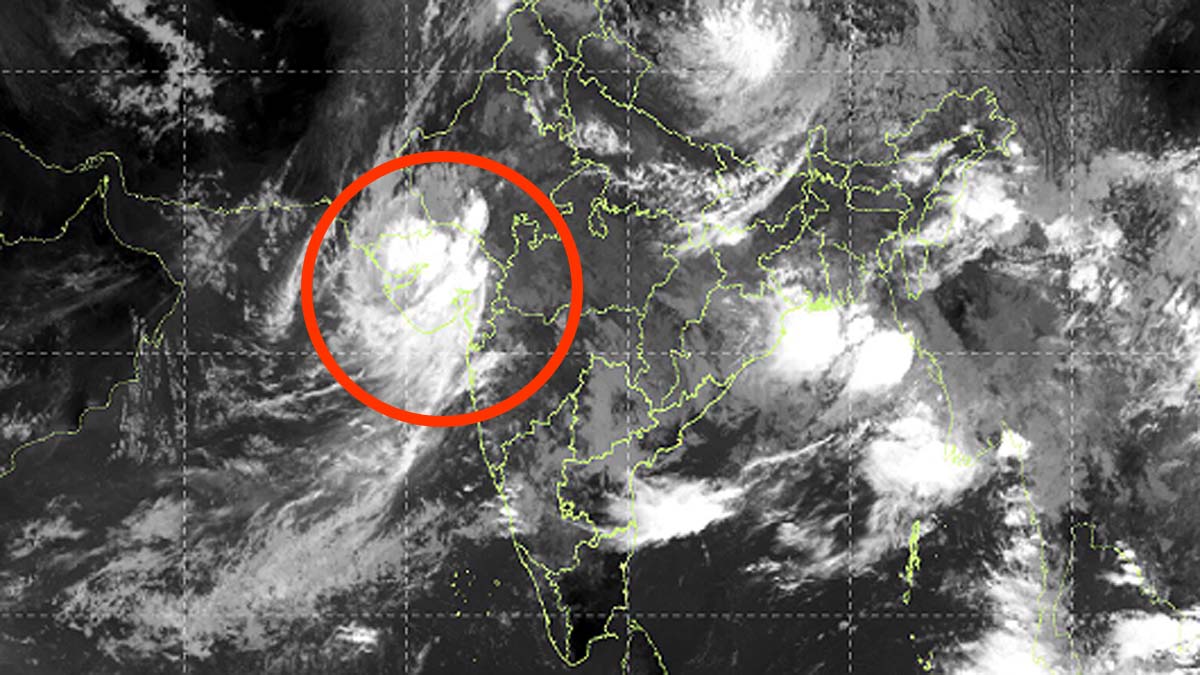
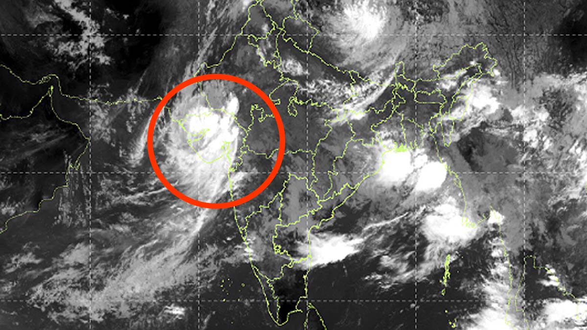
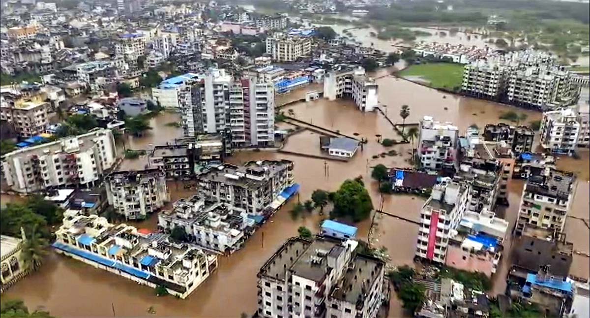
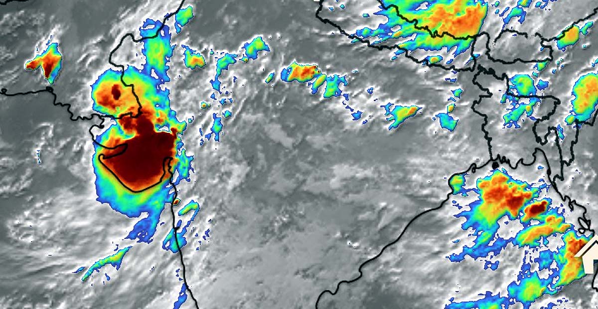
These days monsoon has shown its terrible form in Gujarat. Not normal rain, but havoc wreaking havoc. More than 400 mm of water has rained in many areas in just 14 hours. 451 mm rainfall was recorded in Chikhali (Navsari), 440 mm in Dholka (Ahmedabad), 431 mm in Khergam, 405 mm in Umarpada (Surat) and 365 mm in Umargaon (Valsad).
The rivers are in spate. Roads have been submerged. The fields have been submerged. Normal life has become disrupted. this rain is normal monsoon It is proving to be more intense and destructive than ever before. Amidst this devastation, a debate has erupted among meteorologists and social media. Several months ago, El Nino was created so much that people were scared of the possibility of drought.
Also read: Complete ‘route map’ of rain captured in satellite images, know what was shown
From local forecasters to American scientists, they had predicted drought by running models. But the reality turned out to be the opposite. Monsoon gave not only normal but also excessive rainfall. The question arises that why did scientists underestimate the Pacific Decadal Oscillation i.e. PDO?
What is the Pacific Decadal Oscillation?
The Pacific Decadal Oscillation (PDO) is a pattern of long-term changes in sea surface temperatures in the Pacific Ocean. It runs in decadal cycles i.e. 20-30 years. it El Nino And it is similar to La Nina (ENSO) but its time period is much longer. ENSO lasts for a few months to two years, while PDO maintains its effect for decades.
PDO has two main phases – positive and negative. In the positive phase, the water near the north-eastern Pacific Ocean coast is warm and the central-north Pacific is cold. In the negative phase, the exact opposite pattern is seen – the north-east coast is cold and the central part is relatively warm. Currently, PDO is in a very strong negative phase in 2026, with index values recorded around -1.3 to -1.6.
Also read: Monsoon clouds and rain are happening all over the country… but why is Delhi dry?
This oscillation not only changes the temperature of the ocean, but also affects air pressure, wind direction and the entire global atmospheric circulation. It has a deep connection with the monsoon of India.
Strong relationship between negative PDO and Indian monsoon
Scientific studies show that negative PDO phase strengthens the Indian summer monsoon. In this, the flow of moist winds over India improves. The monsoon trough strengthens by drawing moisture from the western Pacific and Indian Ocean. Result: Above normal and extremely heavy rainfall in some areas.
On the contrary, positive PDO often leads to weak monsoon and drought conditions in India. If we look at the records of the last few decades, access rainfall has been seen in India during negative PDO periods. This effect is even stronger in parts of western India like Gujarat because Arabian Sea The moisture coming from is directly affected by the PDO pattern.
This year scientists mainly focused on ENSO i.e. El Nino. Despite the weakening of El Nino and the possibility of La Nina, many models showed rainfall deficit. But the negative phase of PDO was so strong that it overrode the effect of ENSO. This is why many forecasts proved wrong.
Also read: “B-1, B-2 and B-52 are raining bombs on Iran, air defense is helpless.
Why was PDO underestimated?
There are many reasons for underestimating PDO. The biggest reason is that PDO is a decadal cycle, whereas weather forecasts focus primarily on the seasonal scale. Short-term drivers like ENSO are easily captured in models, but long-term drivers like PDO are challenging to fully understand and incorporate into models.
Second, the variability of the PDO is underestimated in many models. Climate models are still not able to simulate decadal variability perfectly. As a result, forecasters underestimated the strength of the PDO.
The third reason is the overlap of climate change. Due to global warming, ocean temperatures are increasing, due to which some changes are visible in the PDO pattern. Some studies suggest that warming could make the negative phase of the PDO more intense, but models do not fully understand this interaction.
Gujarat The science behind the disaster in
The heavy rains in Gujarat are not the result of a single system but are part of a larger climate pattern. Negative PDO helped the monsoon trough shift southwards. Continuous moisture is coming from the Arabian Sea. Local factors such as topography and urban flood Made the situation worse.
Areas like Chikhali, Umargaon are geographically such where hilly terrain and proximity to the sea promotes heavy rainfall. More than 400 mm of rain in 24 hours is not normal – it is an extreme event that is becoming more common in the era of climate change.
Also read: Heat becomes silent killer in France, more than 20 thousand deaths in 16 days
This incident reminds us that ENSO should not be considered alone in weather forecasting. It is important to give equal importance to other drivers like PDO, Indian Ocean Dipole (IOD), Atlantic Multidecadal Oscillation (AMO). There is a need to strengthen the multi-decadal forecasting system.
Farmers, administration and common people should also be aware of these big patterns. If PDO remains in negative phase, there will be a possibility of heavy rains and floods in many parts of India in the next few years. Also, the intensity of extreme events is increasing due to climate change. This devastation in Gujarat once again proved that nature cannot be seen from just one angle.
—- End —-