
मॉनसून का रिवर्स गियर… जानिए आने वाले दिनों में मौसम में कैसा बदलाव होगा – reverse gear of monsoon know when it rains
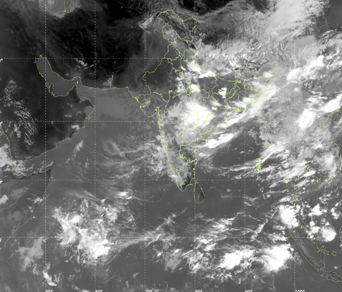
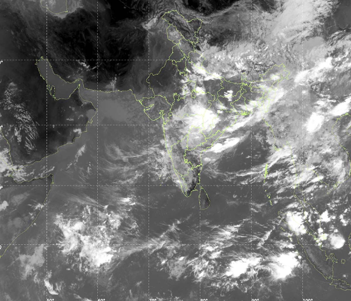
There was a drought-like situation in many parts of the country for a long time, but now the monsoon is finally becoming active. According to weather experts, BSISO near the equator and LPS i.e. low-pressure system have become active in the Bay of Bengal. Due to the meeting of these two weather systems, good rains are expected in North, Eastern and Central India between July 20 and 30.
There are currently two major weather modes in the works…
- First- The Boreal Summer Intraseasonal Oscillation – BSISO – near the equator has entered the positive stage.
- Second – Low-pressure systems associated with Rossby waves are becoming active in the Bay of Bengal. due to the meeting of these two monsoon The speed is increasing. Humidity is increasing towards North India.
According to the forecast of the Meteorological Department and private agencies, heavy rains will start in Uttar Pradesh and Uttarakhand from Saturday. By Sunday-Monday, Punjab, Chandigarh, Delhi, Haryana and East Rajasthan will also come under its purview.
Also read: 10 thousand KM long caravan of clouds, if it reaches Bay of Bengal, there will be heavy rain
Heavy rain alert in North India
There is a possibility of heavy to very heavy rain in many states of North India in the next one week (19-25 July)…
- Uttarakhand: : 300-500mm
- Uttar Pradesh: 200-350mm
- Himachal Pradesh and Jammu: 150-300mm
- Punjab and Chandigarh: 100-200mm
- Haryana and Delhi NCR: 100-150mm
- East Rajasthan: 75-200mm
Also read: Fire broke out in Canada, smoke reached New York… How was its effect visible 1000 KM away?
This rain will be a relief for North India this season, but it is also increasing the danger in the hilly areas. Himachal Pradesh And incidents like landslides, cloud bursts and floods may occur in Uttarakhand this week and next week. People going on a journey have been advised to be cautious.
north-south divide
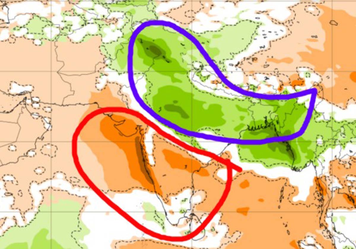
At present the North-South difference is clearly visible in India. According to the ECMWF model, there will be good rainfall over North and East India during July 20-27, while the situation will remain weak over West and South India. Gujarat, Maharashtra, Andhra Pradesh, Telangana And states like Karnataka are likely to receive below average rainfall this week. This may further increase the impact of drought in these areas.
India’s economy and agriculture mainly depend on monsoon. Kharif crops were being affected due to lack of rain in June-July. Farmers may get relief from this sharp return now, but due to sudden heavy rains flood And there is also a possibility of waterlogging.
Experts say that if both BSISO and LPS remain strong, there may be some improvement in South India and the west coast even by the first week of August.
Also read: Orange lips, different voice… 16 years of search, then the world got a new monkey
Cautions and Advice
- People traveling in hilly states should constantly check weather updates.
- There will be a danger of waterlogging in low-lying areas and overflowing rivers.
- Farmers should take care of drainage of water from the fields after heavy rains.
This withdrawal of monsoon is good news for North and East India, but inequality still persists across the country. The weather of the next 10-15 days will decide the overall monsoon situation of the country.
—- End —-